2016 Spring Flood Outlook
Feb 19, 2016
Have you ever wondered what goes into forecast for flooding in the spring? First, what is the forecast for Hennepin County looking like? Right now it looks like Hennepin has a slightly above normal for risk for spring flooding. Here is why:
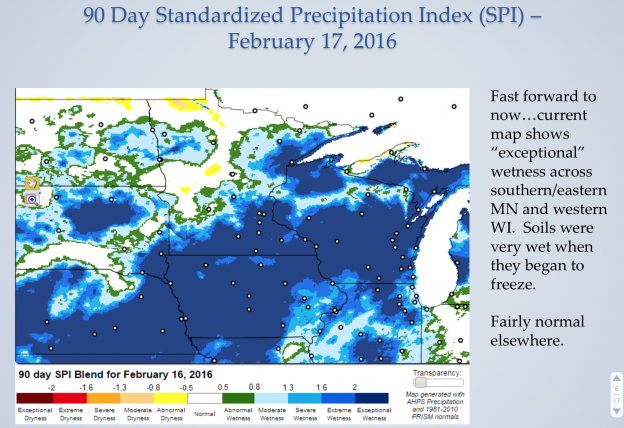
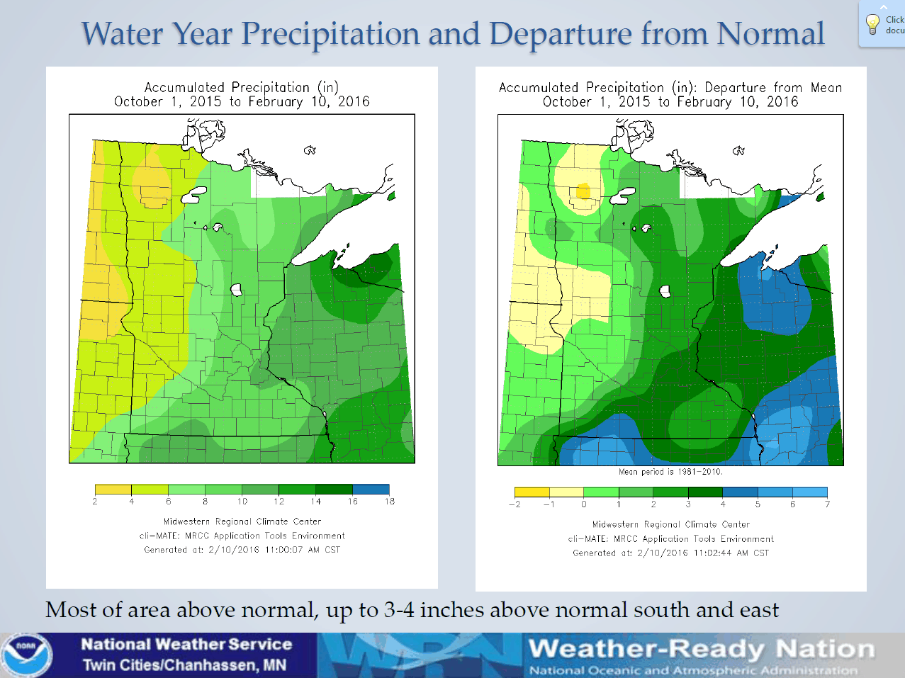
Soil Moisture: MUCH ABOVE normal for Hennepin County.
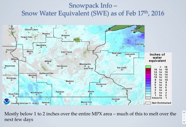
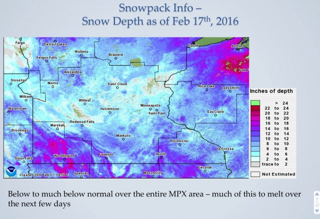
Snowpack: We are a little below normal here, which helps bring down the flood potential some
Frost Depth: A little below, but close to average for Hennepin County.
Here is the forecast:
- If we use previous El Nino years as guidance, slight potential for heavy March rain, likely dry in April, 50-50 for May.
- Current long range models show a little potential for March rain, but nothing heavy yet.
- Temperatures go above normal this weekend, stay there for the most part through March.
- Spring flood potential is Slightly Above Normal for southern and eastern Minnesota, and western Wisconsin including
- Mississippi River and tributaries
- Especially below the twin cities
- Minnesota River
- Especially from the Redwood River downstream
- Including all tributaries in southern MN
- St. Croix and Chippewa (WI) Rivers
- Spring Flood Potential is Low to Normal for northern and western areas
Also note:
- Ice jam flood threat to greatly increase on smaller creeks/tributaries by this weekend, then larger streams and rivers through the end of the month
- The next Spring Flood Outlook is scheduled for the first week of March
- Check the latest conditions and forecasts at: water.weather.gov
- Zoom to your area or select in menu on right
- Check out "Experimental Long-Range Flood Risk" tab for seasonal forecast information
BUT…there are some Wildcards to think about….
- Late Winter Snow Potential? …. Chance are below normal right now, nothing big on the horizon.
- Spring Rain?…..This could be the main driving factor in what spring flooding occurs. Heavy rainfall in high soil moisture areas (HENNEPIN), especially before we have a chance for frost to completely thaw, would bring increased flood potential.
So right now…. Only time will tell – Another forecast will be issued by the National Weather Service the first week of March!