Mid-August Hail Storm
Aug 24, 2023
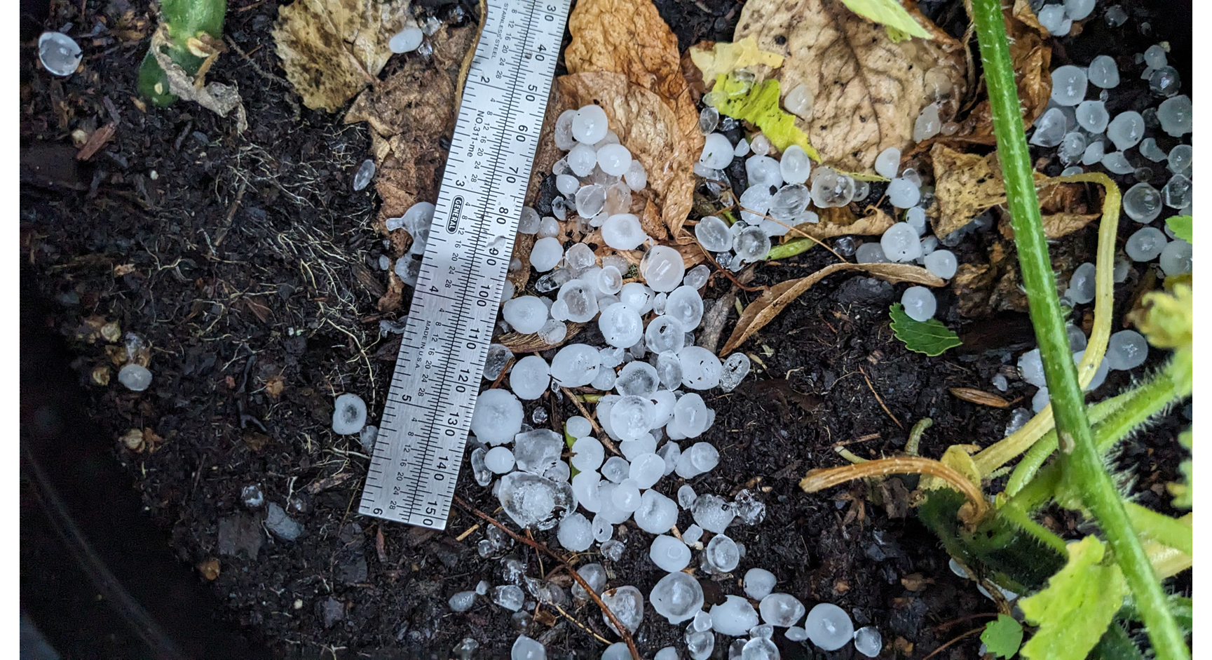
A severe thunderstorm watch had been issued in the early afternoon of August 11th, with the potential for large hail and damaging winds being the main concern. During the evening commute, multiple severe thunderstorm warnings were issued for Hennepin County. The storms started out as fairly small, isolated supercells north of the county, but by the time they made their way through the northwestern suburbs, the cluster of storms had merged and strengthened, producing over two inch size hail that had been being observed throughout the east central portion of the county. Damaged cars, foliage, and urban street flooding was seen throughout the Twin Cities area.
With watches and warnings being issued, it is important to understand the difference between the two:
A watch is when ingredients for a potential weather threat are in your area and are expected to occur in a few hours. When a watch is given, this is your time to create your plan of action.
A warning is when a weather threat is currently happening and will likely impact your area soon. This is when you need to take action.
In the case of a severe thunderstorm warning, it means a thunderstorm with hail one inch or larger and/or winds in excess of 58 mph has developed. In rare cases, a 'tornado possible' tag could also be used if there is the potential for a tornado. A tornado warning is issued when a tornado has been observed by a storm spotter or is indicated on radar.