Hot and Stormy Memorial Day Weekend
May 30, 2018
This past weekend did not seem like your typical weekend in May. The air quality was unhealthy for sensitive groups and the heat was intense and long lived. Not to mention the storms Monday and Tuesday, that dropped a lot of rain in Hennepin County. The highest rainfall total, of 2.13 inches, was reported at the Minnetrista Mesonet station on Tuesday. The main issue Hennepin County experienced with the storms, were power outages from the strong wind gusts. Hopefully everyone was able to stay safe, hydrated, and cool throughout the weekend.
The table below shows the maximum temperatures recorded at each station over the weekend.
| Maximum Temperature (°F) | |||
|---|---|---|---|
| Station | Saturday, May 26 | Sunday, May 27 | Monday, May 28 |
| Chanhassen | 92 | 90 | 99 |
| Fridley | 94 | 92 | 101 |
| Greenfield | 94 | 90 | 98 |
| Hanover | 95 | 92 | 97 |
| Maple Grove | 95 | 91 | 100 |
| Medina | 93 | 89 | 98 |
| Minnetrista | 94 | 90 | 99 |
| MSP Airport | 92 | 90 | 100 |
| Orono | 95 | 91 | 99 |
| Rockford | 93 | 90 | 98 |
| St. Bonifacius | 96 | 91 | 102 |
| Average of all stations | 94 | 90.3 | 99 |
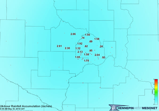
24-hour Rainfall Accumulation (inches) May 29, 2018
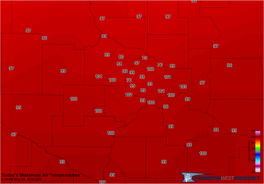
Maximum Air Temperatures May 28, 2018
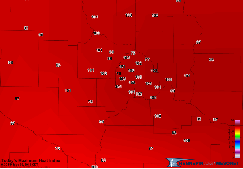
Maximum Heat Index May 28, 2018