Mid-April Snow Storm
Apr 14, 2018
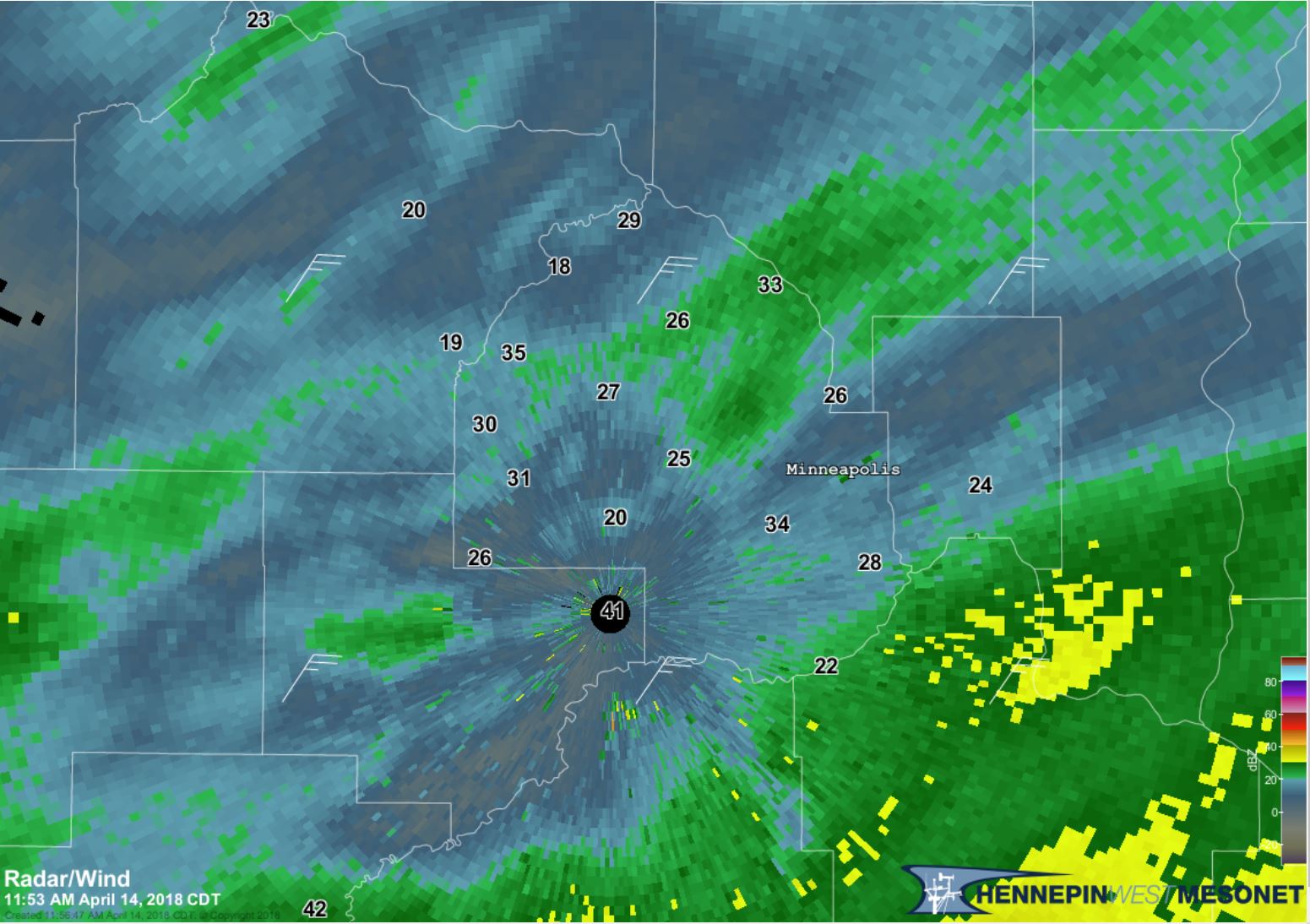
The snow just doesn’t want to stop this year. Hennepin County is still in a Winter Storm Warning, that was issued from Friday, April 13 at 10 p.m. until Sunday, April 15 at 1 a.m., by the National Weather Service. This historic winter storm, has forced MnDOT to shut down numerous roads in southwest Minnesota, and will continue to drop more snow well into Sunday.
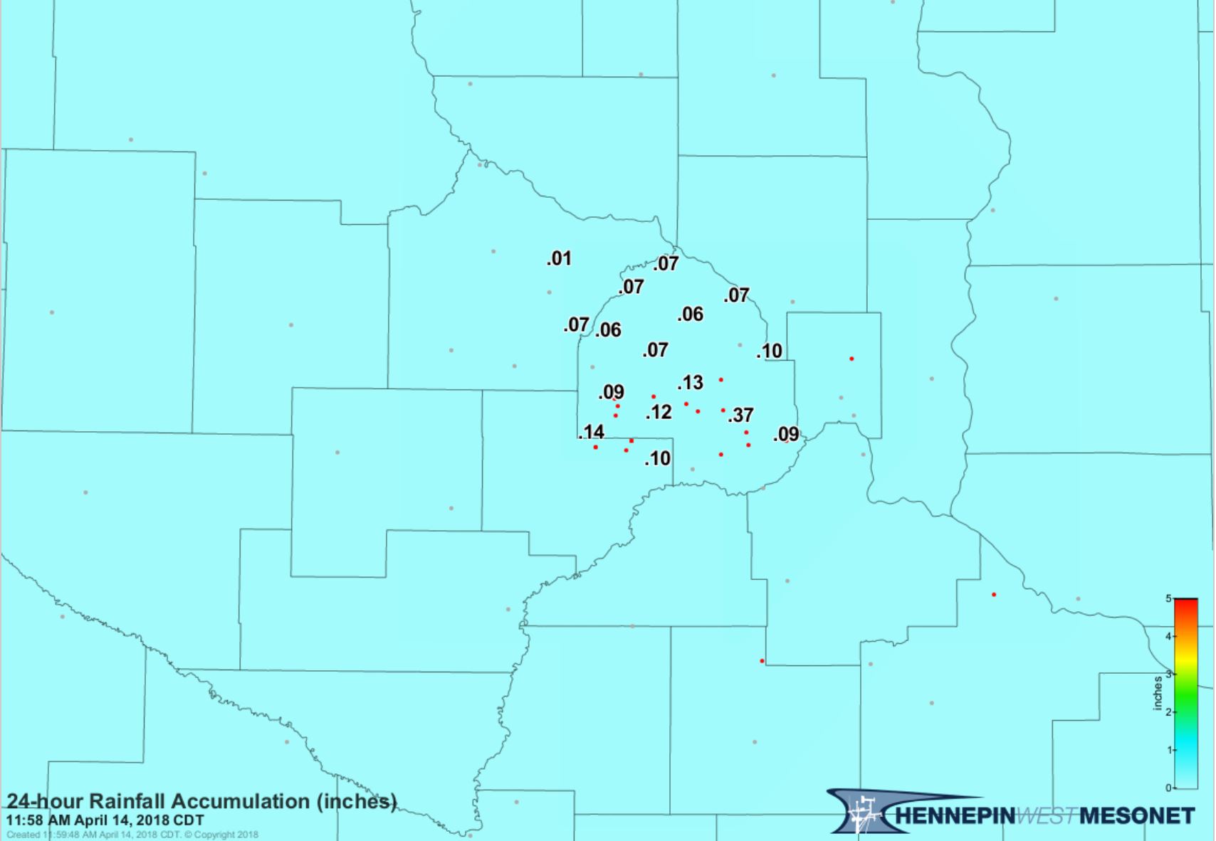
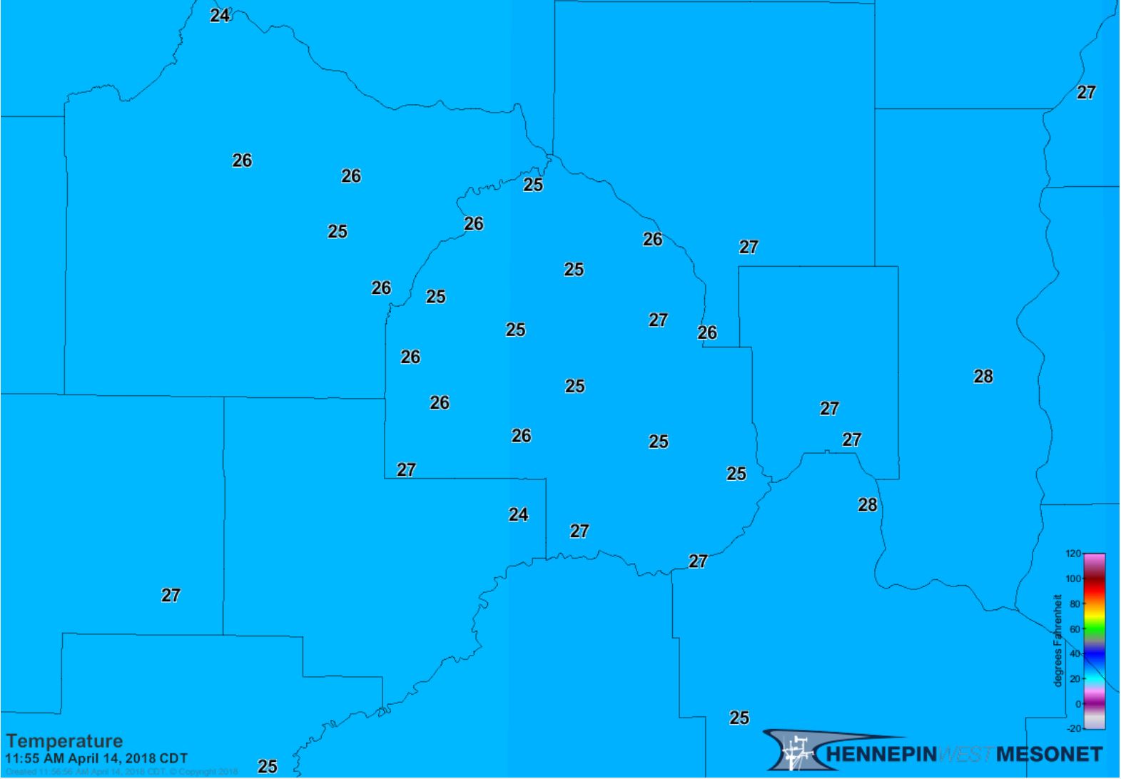
In Hennepin County, temperatures just before noon were in the mid- to upper-20s, with anywhere from .06 to .37 inches of liquid accumulated precipitation. With more snow on its way, we will see the precipitation values increase as we near Sunday. Hennepin County Mesonet stations have not broken the record minimum temperature on April 14, set in 1962 at 2°F, but we are at least 9°F below the normal minimum temperature for April 14.